Waterway information

Kind:
Lower
Driving areas:
🇬🇧 United Kingdom
Length:
3.2 km¹
¹River kilometers or bank length recorded in NavShip, including river arms and harbor entrances.
Availability:
Completely recorded
Recent Update: 10.07.2025²
² This date indicates when an adjustment last took place in the course of the body of water
Recorded:
Locks: 0
Harbours / marinas: 2
Bridges: 0
Berths: 0
Slipways: 0
Fuelstations: 0
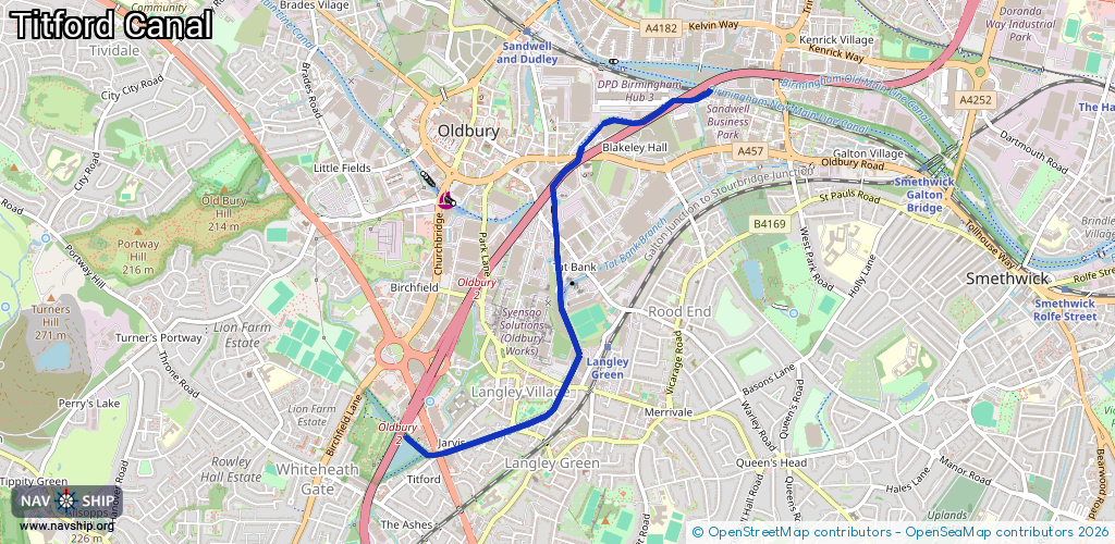
Route:
Please wait, loading route graphic...
Request waterway overview map with symbol legend here (Link).
Information about data associated with this body of water (2 available):
Data by OpenSeaMap (c) OSM contributors, www.openseamap.org
| # | Kind | Coordinates | Name | Information |
|---|---|---|---|---|
| 1 | Marina | 52.49652,-2.00829 | 2025-10-04T11:16:09Z | Titford Pumphouse Residential Moorings [email protected] +44 303 040 4040 https://www.watersidemooring.com/581-titford-pump-house-l1-leisure |
| 2 | Marina | 52.50035,-2.01766 | 2026-01-02T20:01:58Z | Valencia Wharf Covers Whimsey Bridge (west)- 12 spaces, Whimsey Bridge (east)- 8 spaces moorings https://canalplan.uk/place/fvex http://www.birmingham-canalwalks.co.uk/assets/images/2014-smethwick-netherton-034-800x600.jpg |