Waterway information

Kind:
Inland
Driving areas:
🇳🇱 Netherlands
Length:
14.1 km¹
¹River kilometers or bank length recorded in NavShip, including river arms and harbor entrances.
Availability:
Completely recorded
Recent Update: 28.09.2023²
² This date indicates when an adjustment last took place in the course of the body of water
Recorded:
Locks: 0
Harbours / marinas: 2
Bridges: 0
Berths: 3
Slipways: 0
Fuelstations: 0
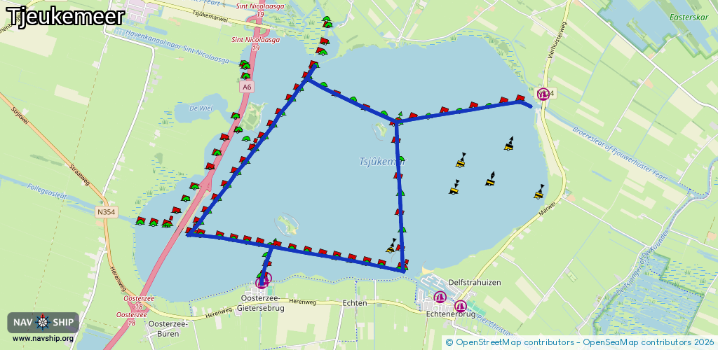
Route:
Please wait, loading route graphic...
Request waterway overview map with symbol legend here (Link).
Information about data associated with this body of water (5 available):
Data by OpenSeaMap (c) OSM contributors, www.openseamap.org
| # | Kind | Coordinates | Name | Information |
|---|---|---|---|---|
| 1 | Marina | 52.87645,5.7754 | 2021-03-29T14:02:31Z | Oude Haven Oosterzee |
| 2 | Marina | 52.8771,5.77633 | 2024-03-07T09:17:00Z | Jachthaven Plaatselijk Belang Oosterzee |
| 3 | Berth | 52.89893,5.80439 | 2025-09-14T20:27:09Z | TJ14A |
| 4 | Berth | 52.88533,5.78057 | 2023-11-21T00:33:10Z | TJ15D |
| 5 | Berth | 52.88498,5.78307 | 2023-11-21T00:33:18Z | TJ15I |