Waterway information

Kind:
Inland
Driving areas:
🌊 Atlantic Ocean🇺🇸 United States of America
Length:
58 km¹
¹River kilometers or bank length recorded in NavShip, including river arms and harbor entrances.
Availability:
Completely recorded
Recent Update: 09.04.2025²
² This date indicates when an adjustment last took place in the course of the body of water
Recorded:
Locks: 0
Harbours / marinas: 5
Bridges: 0
Berths: 0
Slipways: 1
Fuelstations: 0
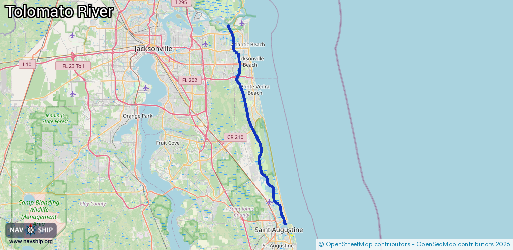
Route:
Please wait, loading route graphic...
Request waterway overview map with symbol legend here (Link).
Information about data associated with this body of water (6 available):
Data by OpenSeaMap (c) OSM contributors, www.openseamap.org
| # | Kind | Coordinates | Name | Information |
|---|---|---|---|---|
| 1 | Marina | 30.32113,-81.44124 | 2020-05-19T23:08:03Z | Harbortown Marina |
| 2 | Marina | 30.28663,-81.42605 | 2020-05-19T23:08:03Z | The Moorings |
| 3 | Marina | 30.25622,-81.43163 | 2020-05-19T23:08:03Z | |
| 4 | Marina | 29.91727,-81.29899 | 2020-05-19T23:08:03Z | Inlet Marina |
| 5 | Marina | 29.91628,-81.2979 | 2022-01-19T21:35:51Z | Saint Augustine Marina |
| 6 | Slipway | 30.28724,-81.42549 | Unknown | 2016-08-29T11:46:39Z |