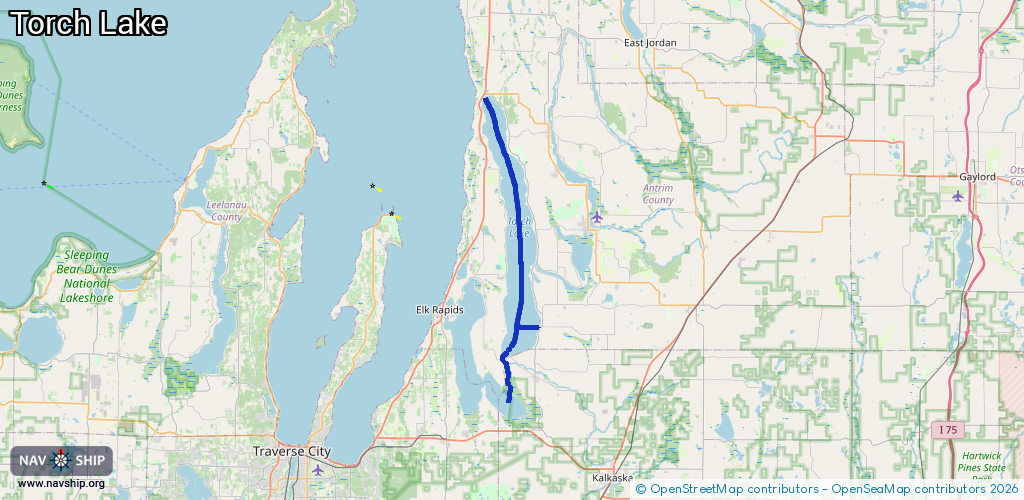
Waterway information

Kind:
Inland
Driving areas:
🇺🇸 United States of America
Length:
36.7 km¹
¹River kilometers or bank length recorded in NavShip, including river arms and harbor entrances.
Availability:
Completely recorded
Recent Update: 21.02.2024²
² This date indicates when an adjustment last took place in the course of the body of water
Recorded:
Locks: 0
Harbours / marinas: 3
Bridges: 0
Berths: 0
Slipways: 0
Fuelstations: 2
Route:
Please wait, loading route graphic...
Request waterway overview map with symbol legend here (Link).
Information about data associated with this body of water (5 available):
Data by OpenSeaMap (c) OSM contributors, www.openseamap.org
| # | Kind | Coordinates | Name | Information |
|---|---|---|---|---|
| 1 | Marina | 44.84855,-85.3285 | 2025-11-23T12:45:03Z | Sun Life’s Torch River Marina +1-231-322-4495 https://sunlifetorchriver.com/ |
| 2 | Marina | 44.83502,-85.32171 | 2025-05-23T02:03:00Z | Luhrs Landing +1 231 322 2868 https://luhrslanding.com/ |
| 3 | Marina | 44.88125,-85.27802 | 2021-06-14T14:44:23Z | |
| 4 | Fuel station | 44.85013,-85.32732 | 2025-05-16T20:03:10Z | |
| 5 | Fuel station | 44.83448,-85.32033 | 2025-05-23T02:03:00Z |