Waterway information

Kind:
Inland
Driving areas:
🇫🇮 Finland
Length:
88 km¹
¹River kilometers or bank length recorded in NavShip, including river arms and harbor entrances.
Availability:
Completely recorded
Recent Update: 07.03.2024²
² This date indicates when an adjustment last took place in the course of the body of water
Recorded:
Locks: 0
Harbours / marinas: 6
Bridges: 0
Berths: 0
Slipways: 1
Fuelstations: 0
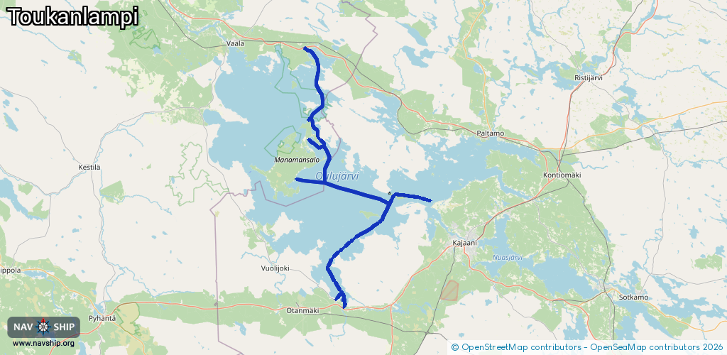
Route:
Please wait, loading route graphic...
Request waterway overview map with symbol legend here (Link).
Information about data associated with this body of water (7 available):
Data by OpenSeaMap (c) OSM contributors, www.openseamap.org
| # | Kind | Coordinates | Name | Information |
|---|---|---|---|---|
| 1 | Marina | 64.39655,27.12899 | 2021-04-04T13:58:59Z | Vierasvenesatama |
| 2 | Marina | 64.54909,27.11133 | 2022-06-28T20:48:36Z | |
| 3 | Marina | 64.12764,27.25758 | 2019-05-22T10:32:12Z | Vuottolahti |
| 4 | Marina | 64.12896,27.23295 | 2019-04-30T23:36:03Z | Kirppuniemi |
| 5 | Marina | 64.42883,27.12955 | 2019-05-06T15:14:28Z | Kilonniemen kalasatama |
| 6 | Marina | 64.33115,27.08093 | 2023-01-22T16:38:42Z | Venesatama |
| 7 | Slipway | 64.12764,27.25758 | small_craft_facility | 2019-05-22T10:32:12Z Vuottolahti |