Waterway information

Kind:
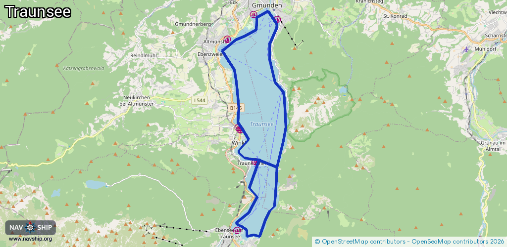
Lake
Driving areas:
🇦🇹 Austria
Length:
29.3 km¹
¹River kilometers or bank length recorded in NavShip, including river arms and harbor entrances.
Availability:
Completely recorded
Recent Update: 22.02.2026²
² This date indicates when an adjustment last took place in the course of the body of water
Recorded:
Locks: 0
Harbours / marinas: 7
Bridges: 0
Berths: 0
Slipways: 1
Fuelstations: 0
Route:
Please wait, loading route graphic...
Request waterway overview map with symbol legend here (Link).
Information about data associated with this body of water (8 available):
Data by OpenSeaMap (c) OSM contributors, www.openseamap.org
| # | Kind | Coordinates | Name | Information |
|---|---|---|---|---|
| 1 | Marina | 47.91412,13.79099 | 2021-03-22T18:12:33Z | UYC-Traunsee |
| 2 | Marina | 47.91192,13.80733 | 2021-03-22T22:29:53Z | ASKÖ Gmunden Segeln |
| 3 | Marina | 47.81339,13.77947 | 2021-01-28T16:44:54Z | Segelclub Ebensee |
| 4 | Marina | 47.84555,13.79242 | 2021-03-22T00:12:16Z | |
| 5 | Marina | 47.86136,13.78047 | 2021-03-22T00:12:16Z | |
| 6 | Marina | 47.86036,13.78182 | 2021-03-22T00:12:16Z | |
| 7 | Marina | 47.90252,13.77279 | 2023-03-02T22:06:22Z | Segelclub Altmünster |
| 8 | Slipway | 47.87147,13.77886 | small_craft_facility | 2018-01-05T08:18:55Z |