Waterway information

Kind:
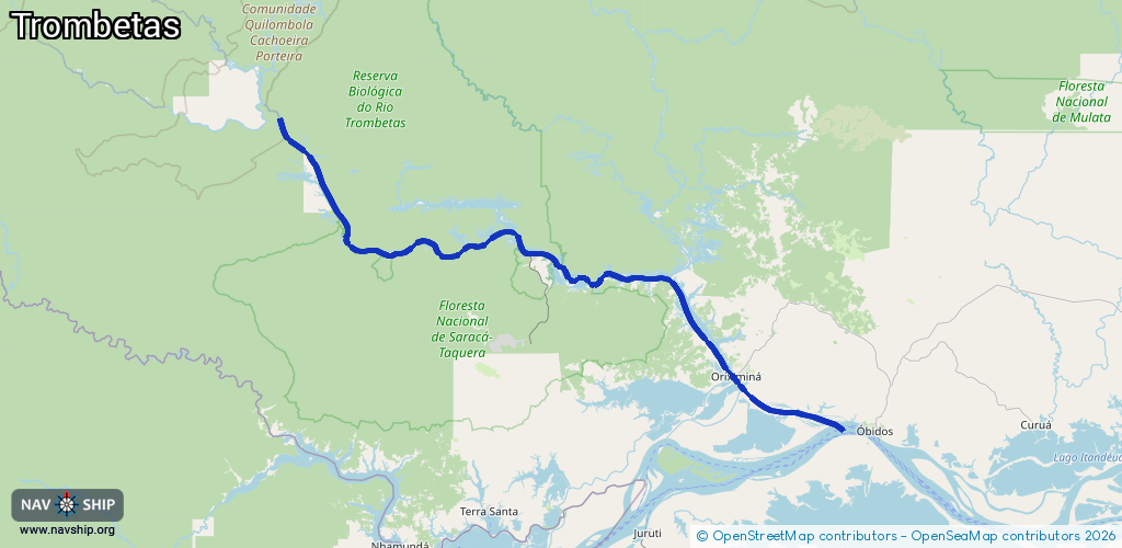
Inland
Driving areas:
🇧🇷 Brazil
Length:
215.9 km¹
¹River kilometers or bank length recorded in NavShip, including river arms and harbor entrances.
Availability:
Completely recorded
Recent Update: 20.09.2024²
² This date indicates when an adjustment last took place in the course of the body of water
Recorded:
Locks: 0
Harbours / marinas: 3
Bridges: 0
Berths: 8
Slipways: 0
Fuelstations: 0
Route:
Please wait, loading route graphic...
Request waterway overview map with symbol legend here (Link).
Information about data associated with this body of water (11 available):
Data by OpenSeaMap (c) OSM contributors, www.openseamap.org
| # | Kind | Coordinates | Name | Information |
|---|---|---|---|---|
| 1 | Marina | -1.46218,-56.37195 | 2014-09-06T11:06:45Z | |
| 2 | Marina | -1.46158,-56.37993 | 2014-06-22T02:10:50Z | Porto Trombetas |
| 3 | Marina | -1.77044,-55.86881 | 2014-06-22T02:10:51Z | |
| 4 | Berth | -1.46122,-56.38431 | 2012-11-02T15:28:46Z | |
| 5 | Berth | -1.46243,-56.37185 | 2012-11-02T15:27:24Z | |
| 6 | Berth | -1.46052,-56.37607 | 2012-11-02T15:27:35Z | |
| 7 | Berth | -1.46077,-56.3768 | 2012-11-02T15:27:38Z | |
| 8 | Berth | -1.46118,-56.38057 | 2012-11-02T15:27:42Z | |
| 9 | Berth | -1.46012,-56.38061 | 2012-11-02T15:28:52Z | |
| 10 | Berth | -1.46087,-56.37779 | 2025-04-29T19:29:55Z | |
| 11 | Berth | -1.5175,-56.09573 | 2012-11-02T15:27:45Z |