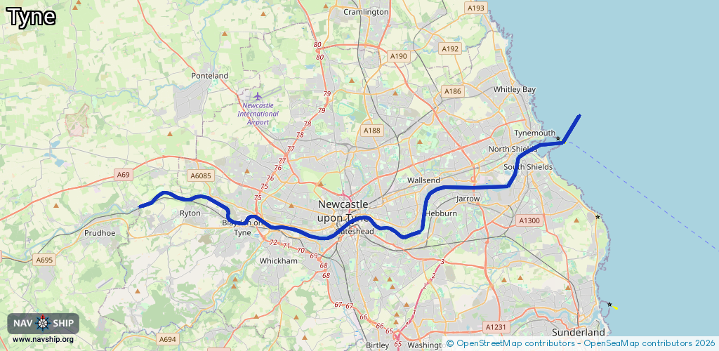
Waterway information

Kind:
Sea
Driving areas:
🌊 North Sea🇬🇧 United Kingdom
Length:
34.7 km¹
¹River kilometers or bank length recorded in NavShip, including river arms and harbor entrances.
Availability:
Completely recorded
Recent Update: 21.08.2023²
² This date indicates when an adjustment last took place in the course of the body of water
Recorded:
Locks: 0
Harbours / marinas: 3
Bridges: 1
Berths: 0
Slipways: 1
Fuelstations: 0
Route:
Please wait, loading route graphic...
Request waterway overview map with symbol legend here (Link).
Information about data associated with this body of water (5 available):
Data by OpenSeaMap (c) OSM contributors, www.openseamap.org
| # | Kind | Coordinates | Name | Information |
|---|---|---|---|---|
| 1 | Marina | 54.9657,-1.5726 | 2021-04-01T20:19:06Z | |
| 2 | Marina | 54.99517,-1.45135 | 2025-10-04T12:58:33Z | Royal Quays Marina https://www.sweetwilliam.uk/ |
| 3 | Marina | 54.99635,-1.45238 | 2024-03-22T01:05:43Z | Royal Quays Marina |
| 4 | Bridge | 54.96987,-1.59916 | Unknown | Clearance height: 2020-04-26T06:21:39Z m Maximum passage width: 25 m Movable bridge (e.g. lifting bridge or drawbridge) lifting |
| 5 | Slipway | 54.99671,-1.4524 | Unknown | 2011-10-17T18:56:45Z |