Waterway information

Kind:
Inland
Driving areas:
🇩🇪 Germany
Length:
2.2 km¹
¹River kilometers or bank length recorded in NavShip, including river arms and harbor entrances.
Availability:
Completely recorded
Recent Update: 09.01.2023²
² This date indicates when an adjustment last took place in the course of the body of water
Recorded:
Locks: 0
Harbours / marinas: 3
Bridges: 0
Berths: 0
Slipways: 3
Fuelstations: 0
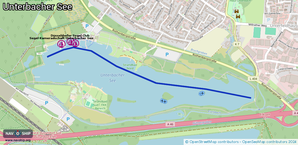
Route:
Please wait, loading route graphic...
Request waterway overview map with symbol legend here (Link).
Information about data associated with this body of water (6 available):
Data by OpenSeaMap (c) OSM contributors, www.openseamap.org
| # | Kind | Coordinates | Name | Information |
|---|---|---|---|---|
| 1 | Marina | 51.19883,6.88235 | 2023-11-06T07:50:29Z | Düsseldorfer Segel Club [email protected] +49 2103 2957278 https://www.dscu.de/ |
| 2 | Marina | 51.19884,6.8832 | 2022-07-21T16:48:48Z | |
| 3 | Marina | 51.1986,6.881 | 2017-07-14T19:37:07Z | Segel-Kameradschaft Unterbacher See [email protected] +49 211 7404382 http://www.sku-duesseldorf.de/ |
| 4 | Slipway | 51.19875,6.88494 | small_craft_facility | 2014-01-30T22:57:41Z |
| 5 | Slipway | 51.19855,6.88746 | small_craft_facility | 2017-07-14T19:37:08Z |
| 6 | Slipway | 51.19905,6.88223 | small_craft_facility | 2014-01-30T22:57:41Z |