Waterway information

Kind:
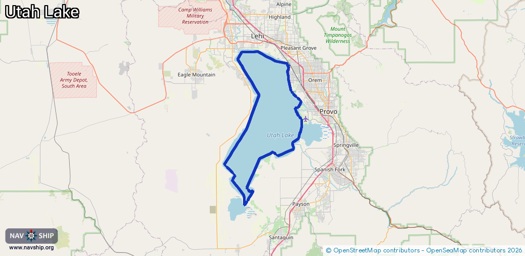
Lake
Driving areas:
🇺🇸 United States of America
Length:
96.4 km¹
¹River kilometers or bank length recorded in NavShip, including river arms and harbor entrances.
Availability:
Completely recorded
Recent Update: 11.06.2024²
² This date indicates when an adjustment last took place in the course of the body of water
Recorded:
Locks: 0
Harbours / marinas: 3
Bridges: 0
Berths: 0
Slipways: 2
Fuelstations: 0
Route:
Please wait, loading route graphic...
Request waterway overview map with symbol legend here (Link).
Information about data associated with this body of water (5 available):
Data by OpenSeaMap (c) OSM contributors, www.openseamap.org
| # | Kind | Coordinates | Name | Information |
|---|---|---|---|---|
| 1 | Marina | 40.29036,-111.87023 | 2025-07-30T20:59:49Z | Lake Mountain Marina |
| 2 | Marina | 40.30403,-111.88033 | 2026-02-18T03:28:03Z | El Nautica Boat Club https://elnauticaboatclub.org/ |
| 3 | Marina | 40.32771,-111.76501 | 2023-10-07T04:24:20Z | Lindon Marina |
| 4 | Slipway | 40.32665,-111.7649 | Unknown | 2025-10-02T19:58:02Z |
| 5 | Slipway | 40.32683,-111.76441 | Unknown | 2025-10-02T19:58:02Z |