Waterway information

Kind:
Inland
Driving areas:
🇲🇽 Mexico
Length:
6.7 km¹
¹River kilometers or bank length recorded in NavShip, including river arms and harbor entrances.
Availability:
Completely recorded
Recent Update: 11.02.2026²
² This date indicates when an adjustment last took place in the course of the body of water
Recorded:
Locks: 0
Harbours / marinas: 4
Bridges: 0
Berths: 0
Slipways: 0
Fuelstations: 0
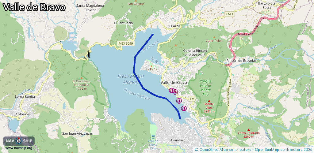
Route:
Please wait, loading route graphic...
Request waterway overview map with symbol legend here (Link).
Information about data associated with this body of water (4 available):
Data by OpenSeaMap (c) OSM contributors, www.openseamap.org
| # | Kind | Coordinates | Name | Information |
|---|---|---|---|---|
| 1 | Marina | 19.18039,-100.12598 | 2026-02-03T04:42:32Z | Club Nautico |
| 2 | Marina | 19.1844,-100.12877 | 2026-02-03T04:42:32Z | Club de Vela Santa Maria |
| 3 | Marina | 19.18916,-100.13089 | 2026-02-03T04:42:32Z | Capitanía de Puerto |
| 4 | Marina | 19.18984,-100.13276 | 2025-04-03T10:04:18Z | Marina Azul |