Waterway information

Kind:
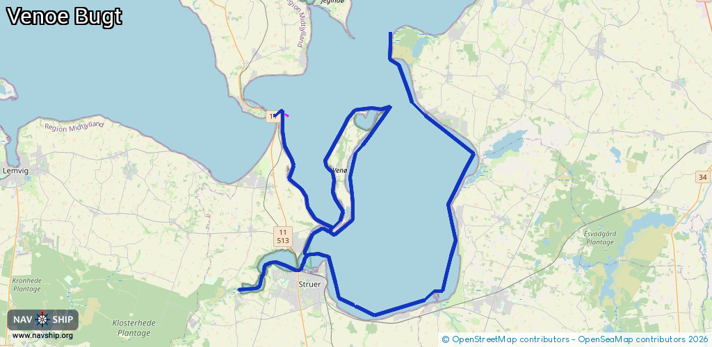
Lake
Driving areas:
🇩🇰 Denmark
Length:
67 km¹
¹River kilometers or bank length recorded in NavShip, including river arms and harbor entrances.
Availability:
Completely recorded
Recent Update: 17.11.2025²
² This date indicates when an adjustment last took place in the course of the body of water
Recorded:
Locks: 0
Harbours / marinas: 3
Bridges: 2
Berths: 0
Slipways: 1
Fuelstations: 0
Route:
Please wait, loading route graphic...
Request waterway overview map with symbol legend here (Link).
Information about data associated with this body of water (6 available):
Data by OpenSeaMap (c) OSM contributors, www.openseamap.org
| # | Kind | Coordinates | Name | Information |
|---|---|---|---|---|
| 1 | Marina | 56.54864,8.57422 | 2022-03-05T07:15:13Z | Humlum Fiskerleje [email protected] +45 21 417352 http://www.humlumbaadelaug.dk/ |
| 2 | Marina | 56.48117,8.71972 | 2024-01-16T11:47:21Z | Handbjerg Marina https://www.handbjergmarina.com/ |
| 3 | Marina | 56.57986,8.7098 | 2024-06-09T08:12:51Z | Gyldendal Havn +45 21132302 https://www.gyldendalhavn.dk/ |
| 4 | Bridge | 56.49433,8.58328 | Unknown | Clearance height: 2024-10-10T05:55:54Z m fixed |
| 5 | Bridge | 56.49443,8.58512 | Unknown | Clearance height: 2024-10-10T05:55:54Z m fixed |
| 6 | Slipway | 56.58103,8.71044 | small_craft_facility | 2013-04-03T10:02:07Z |