Waterway information

Kind:
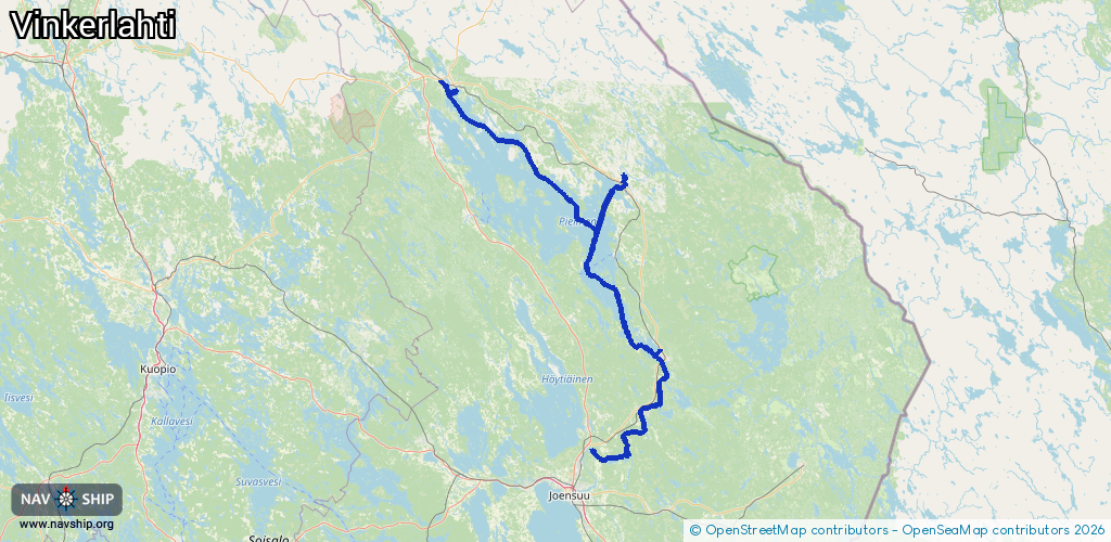
Inland
Driving areas:
🇫🇮 Finland
Length:
172.5 km¹
¹River kilometers or bank length recorded in NavShip, including river arms and harbor entrances.
Availability:
Completely recorded
Recent Update: 07.03.2024²
² This date indicates when an adjustment last took place in the course of the body of water
Recorded:
Locks: 1
Harbours / marinas: 3
Bridges: 0
Berths: 0
Slipways: 0
Fuelstations: 1
Route:
Please wait, loading route graphic...
Request waterway overview map with symbol legend here (Link).
Information about data associated with this body of water (4 available):
Data by OpenSeaMap (c) OSM contributors, www.openseamap.org
| # | Kind | Coordinates | Name | Information |
|---|---|---|---|---|
| 1 | Marina | 62.93678,30.21709 | 2021-02-26T16:00:32Z | |
| 2 | Marina | 63.54252,29.13071 | 2021-07-15T05:15:33Z | Nurmeksen satama |
| 3 | Marina | 63.31022,30.01221 | 2021-02-13T20:31:45Z | Kaupunginniemi venesatama |
| 4 | Fuel station | 63.53206,29.18079 | 2023-08-12T10:36:32Z | ABC Veneasema Bomba ABC 24/7 https://www.abcasemat.fi/fi/asemat/abc-veneasema-bomba-0643543 |
| 4 | Fuel station | 63.53206,29.18079 | 2023-08-12T10:36:32Z | ABC Veneasema Bomba ABC 24/7 https://www.abcasemat.fi/fi/asemat/abc-veneasema-bomba-0643543 |