Waterway information

Kind:
Inland
Driving areas:
🇳🇱 Netherlands
Length:
23.1 km¹
¹River kilometers or bank length recorded in NavShip, including river arms and harbor entrances.
Availability:
Completely recorded
Recent Update: 11.02.2025²
² This date indicates when an adjustment last took place in the course of the body of water
Recorded:
Locks: 0
Harbours / marinas: 2
Bridges: 3
Berths: 0
Slipways: 0
Fuelstations: 0
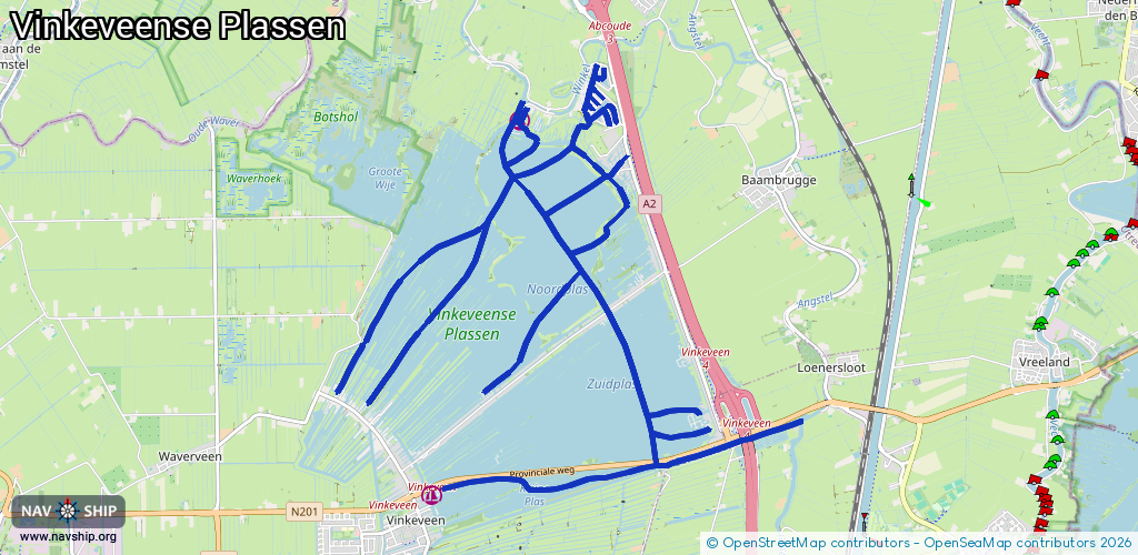
Route:
Please wait, loading route graphic...
Request waterway overview map with symbol legend here (Link).
Information about data associated with this body of water (5 available):
Data by OpenSeaMap (c) OSM contributors, www.openseamap.org
| # | Kind | Coordinates | Name | Information |
|---|---|---|---|---|
| 1 | Marina | 52.21766,4.93723 | 2025-09-09T06:30:33Z | Zeilschool Haven Vinkeveen https://www.vinkeveenhaven.nl |
| 2 | Marina | 52.25345,4.95119 | 2022-07-17T14:13:42Z | Jachthaven Bon |
| 3 | Bridge | 52.22086,4.97171 | 9.1 | Clearance height: 2022-06-06T15:45:54Z m Maximum passage width: 2.8 m Movable bridge (e.g. lifting bridge or drawbridge) opening |
| 4 | Bridge | 52.23504,4.96437 | 9.1 | Clearance height: 2023-08-10T21:54:46Z m Maximum passage width: 1 m Movable bridge (e.g. lifting bridge or drawbridge) opening |
| 5 | Bridge | 52.22307,4.98591 | Unknown | Clearance height: 2012-12-21T14:49:24Z m Maximum passage width: 3.9 m Movable bridge (e.g. lifting bridge or drawbridge) fixed |