Waterway information

Kind:
Inland
Driving areas:
🇳🇱 Netherlands🌊 North Sea
Length:
4.7 km¹
¹River kilometers or bank length recorded in NavShip, including river arms and harbor entrances.
Availability:
Completely recorded
Recent Update: 04.03.2025²
² This date indicates when an adjustment last took place in the course of the body of water
Recorded:
Locks: 0
Harbours / marinas: 0
Bridges: 14
Berths: 0
Slipways: 0
Fuelstations: 0
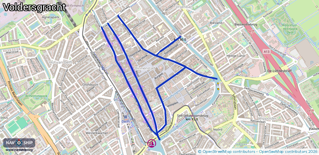
Route:
Please wait, loading route graphic...
Request waterway overview map with symbol legend here (Link).
Information about data associated with this body of water (14 available):
Data by OpenSeaMap (c) OSM contributors, www.openseamap.org
| # | Kind | Coordinates | Name | Information |
|---|---|---|---|---|
| 1 | Bridge | 52.01431,4.3554 | Unknown | Clearance height: 2018-08-29T15:51:17Z m |
| 2 | Bridge | 52.01301,4.35647 | Unknown | Clearance height: 2018-08-28T22:24:43Z m |
| 3 | Bridge | 52.01013,4.35714 | Unknown | Clearance height: 2018-08-28T22:24:44Z m |
| 4 | Bridge | 52.0125,4.35524 | Unknown | Clearance height: 2018-08-28T16:03:37Z m |
| 5 | Bridge | 52.01514,4.3533 | Unknown | Clearance height: 2020-10-30T19:07:35Z m Movable bridge (e.g. lifting bridge or drawbridge) fixed |
| 6 | Bridge | 52.01495,4.35699 | Unknown | Clearance height: 2018-08-28T22:24:43Z m |
| 7 | Bridge | 52.01334,4.35936 | Unknown | Clearance height: 2018-08-28T16:03:37Z m |
| 8 | Bridge | 52.01287,4.36079 | Unknown | Clearance height: 2018-08-28T16:03:38Z m |
| 9 | Bridge | 52.01108,4.36684 | Unknown | Clearance height: 2018-10-09T17:38:55Z m |
| 10 | Bridge | 52.00874,4.36163 | Unknown | Clearance height: 2018-08-28T16:03:37Z m |
| 11 | Bridge | 52.01429,4.36381 | Unknown | Clearance height: 2018-10-18T12:30:53Z m |
| 12 | Bridge | 52.01359,4.36224 | Unknown | Clearance height: 2018-08-28T16:03:38Z m |
| 13 | Bridge | 52.01269,4.3612 | Unknown | Clearance height: 2018-08-29T15:51:17Z m |
| 14 | Bridge | 52.01249,4.36225 | Unknown | Clearance height: 2018-08-28T22:24:42Z m |