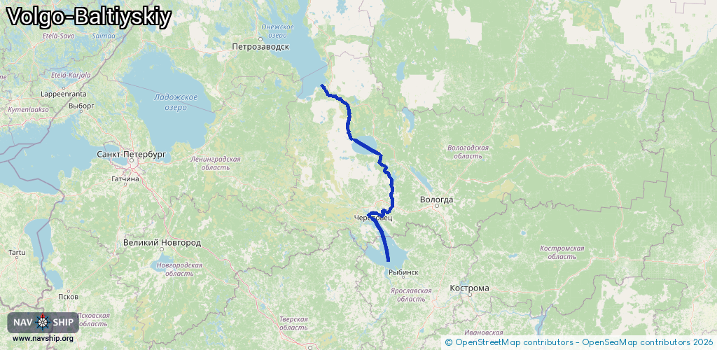
Waterway information

Kind:
Inland
Driving areas:
🇷🇺 Russia
Length:
449.3 km¹
¹River kilometers or bank length recorded in NavShip, including river arms and harbor entrances.
Availability:
Completely recorded
Recent Update: 10.04.2025²
² This date indicates when an adjustment last took place in the course of the body of water
Recorded:
Locks: 7
Harbours / marinas: 0
Bridges: 0
Berths: 0
Slipways: 0
Fuelstations: 0
Route:
Please wait, loading route graphic...
Request waterway overview map with symbol legend here (Link).
Information about data associated with this body of water (7 available):
Data by OpenSeaMap (c) OSM contributors, www.openseamap.org
| # | Kind | Coordinates | Name | Information |
|---|---|---|---|---|
| 1 | Lock | 61.00722,36.42471 | Unknown | |
| 2 | Lock | 60.9487,36.54781 | Unknown | |
| 3 | Lock | 60.94357,36.64982 | Unknown | |
| 4 | Lock | 60.94332,36.67351 | Unknown | |
| 5 | Lock | 60.94236,36.69643 | Unknown | |
| 6 | Lock | 60.90879,36.76847 | Unknown | |
| 7 | Lock | 59.2349,38.50055 | Unknown |