Waterway information

Kind:
Inland
Driving areas:
🇳🇱 Netherlands
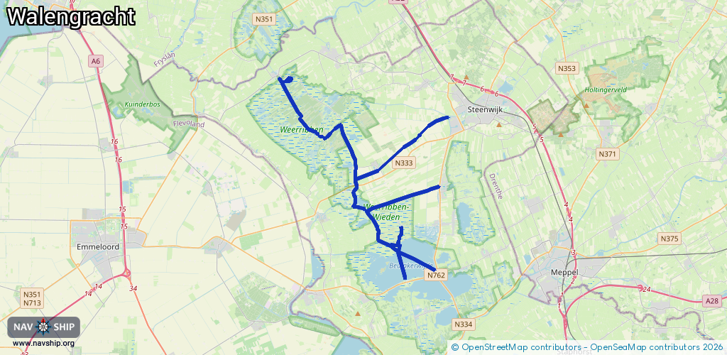
Length:
37.7 km¹
¹River kilometers or bank length recorded in NavShip, including river arms and harbor entrances.
Availability:
Completely recorded
Recent Update: 27.09.2023²
² This date indicates when an adjustment last took place in the course of the body of water
Recorded:
Locks: 0
Harbours / marinas: 1
Bridges: 7
Berths: 0
Slipways: 0
Fuelstations: 0
Route:
Please wait, loading route graphic...
Request waterway overview map with symbol legend here (Link).
Information about data associated with this body of water (8 available):
Data by OpenSeaMap (c) OSM contributors, www.openseamap.org
| # | Kind | Coordinates | Name | Information |
|---|---|---|---|---|
| 1 | Marina | 52.8056,5.92556 | 2022-06-06T07:23:30Z | De Kluft [email protected] +31 561 477 370 https://www.dekluft.nl/index.php/jachthaven_weerribben/ |
| 2 | Bridge | 52.76957,6.04862 | 6.77 | Clearance height: 2022-06-06T07:07:25Z m Maximum passage width: 1 m Movable bridge (e.g. lifting bridge or drawbridge) opening |
| 3 | Bridge | 52.75433,6.01864 | 7.2 | Clearance height: 2022-06-06T07:07:26Z m Maximum passage width: 1 m Movable bridge (e.g. lifting bridge or drawbridge) opening |
| 4 | Bridge | 52.776,5.95562 | 7.55 | Clearance height: 2016-04-15T06:48:03Z m Maximum passage width: 1.22 m Movable bridge (e.g. lifting bridge or drawbridge) opening BB H12 W73 (payment= 2 €) |
| 5 | Bridge | 52.75499,5.9955 | 7 | Clearance height: 2016-04-15T06:48:03Z m Maximum passage width: 1.43 m Movable bridge (e.g. lifting bridge or drawbridge) opening BB H16 W68 |
| 6 | Bridge | 52.74448,5.99652 | 14.3 | Clearance height: 2018-10-23T13:05:55Z m Maximum passage width: 5.46 m Movable bridge (e.g. lifting bridge or drawbridge) fixed H54 W143 |
| 7 | Bridge | 52.80669,5.92845 | Unknown | Clearance height: 2020-10-02T18:17:38Z m |
| 8 | Bridge | 52.80651,5.93296 | Unknown | Clearance height: 2020-10-02T18:17:38Z m |