Waterway information

Kind:
Inland
Driving areas:
🌊 Atlantic Ocean🇺🇸 United States of America
Length:
2.2 km¹
¹River kilometers or bank length recorded in NavShip, including river arms and harbor entrances.
Availability:
Completely recorded
Recent Update: 19.01.2024²
² This date indicates when an adjustment last took place in the course of the body of water
Recorded:
Locks: 0
Harbours / marinas: 0
Bridges: 5
Berths: 0
Slipways: 0
Fuelstations: 0
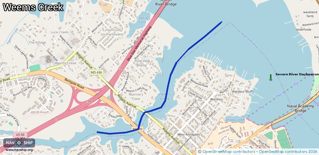
Route:
Please wait, loading route graphic...
Request waterway overview map with symbol legend here (Link).
Information about data associated with this body of water (5 available):
Data by OpenSeaMap (c) OSM contributors, www.openseamap.org
| # | Kind | Coordinates | Name | Information |
|---|---|---|---|---|
| 1 | Bridge | 38.9925,-76.50762 | Unknown | Clearance height: 2024-08-10T05:06:12Z m Movable bridge (e.g. lifting bridge or drawbridge) fixed |
| 2 | Bridge | 38.99295,-76.50832 | Unknown | Clearance height: 2026-01-19T05:31:59Z m Movable bridge (e.g. lifting bridge or drawbridge) fixed |
| 3 | Bridge | 38.99267,-76.50788 | 28 | Clearance height: 2026-01-19T05:31:59Z m Maximum passage width: 8 m Movable bridge (e.g. lifting bridge or drawbridge) swing |
| 4 | Bridge | 38.99106,-76.50921 | 145 | Clearance height: 2025-12-12T02:32:15Z m Maximum passage width: 28 m Movable bridge (e.g. lifting bridge or drawbridge) fixed |
| 5 | Bridge | 38.99112,-76.50913 | 145 | Clearance height: 2025-12-12T02:32:20Z m Maximum passage width: 28 m Movable bridge (e.g. lifting bridge or drawbridge) fixed |