Waterway information

Kind:
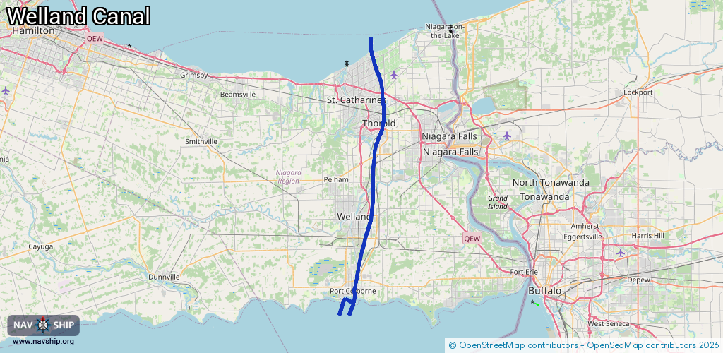
Inland
Driving areas:
🇨🇦 Canada
Length:
49 km¹
¹River kilometers or bank length recorded in NavShip, including river arms and harbor entrances.
Availability:
Completely recorded
Recent Update: 03.10.2025²
² This date indicates when an adjustment last took place in the course of the body of water
Recorded:
Locks: 6
Harbours / marinas: 6
Bridges: 0
Berths: 0
Slipways: 0
Fuelstations: 0
Route:
Please wait, loading route graphic...
Request waterway overview map with symbol legend here (Link).
Information about data associated with this body of water (12 available):
Data by OpenSeaMap (c) OSM contributors, www.openseamap.org
| # | Kind | Coordinates | Name | Information |
|---|---|---|---|---|
| 1 | Marina | 42.87626,-79.27373 | 2024-06-03T14:30:29Z | |
| 2 | Marina | 42.87664,-79.27127 | 2024-06-03T14:30:29Z | |
| 3 | Marina | 42.87758,-79.25776 | 2019-09-14T19:18:35Z | |
| 4 | Marina | 42.8756,-79.25736 | 2019-09-14T19:18:35Z | |
| 5 | Marina | 43.23093,-79.21245 | 2024-06-08T08:32:57Z | |
| 6 | Marina | 42.87677,-79.25484 | 2024-06-03T14:30:29Z | Sugarloaf Harbour Marina |
| 7 | Lock | 43.21741,-79.2134 | Unknown | |
| 8 | Lock | 43.19316,-79.20244 | Unknown | |
| 9 | Lock | 43.15553,-79.19364 | Unknown | |
| 10 | Lock | 43.13176,-79.19237 | Unknown | |
| 11 | Lock | 43.12298,-79.19392 | Unknown | |
| 12 | Lock | 42.88645,-79.24934 | Unknown |