Waterway information

Kind:
Inland
Driving areas:
🇳🇱 Netherlands
Length:
10.2 km¹
¹River kilometers or bank length recorded in NavShip, including river arms and harbor entrances.
Availability:
Completely recorded
Recent Update: 22.05.2023²
² This date indicates when an adjustment last took place in the course of the body of water
Recorded:
Locks: 0
Harbours / marinas: 1
Bridges: 6
Berths: 2
Slipways: 0
Fuelstations: 1
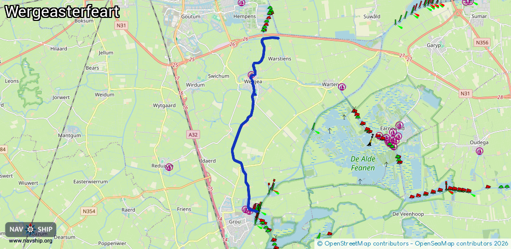
Route:
Please wait, loading route graphic...
Request waterway overview map with symbol legend here (Link).
Information about data associated with this body of water (10 available):
Data by OpenSeaMap (c) OSM contributors, www.openseamap.org
| # | Kind | Coordinates | Name | Information |
|---|---|---|---|---|
| 1 | Marina | 53.15418,5.84317 | 2024-03-17T14:53:16Z | Jachtwerf van der Werff http://jachtwerfvdwerff.nl/ |
| 2 | Bridge | 53.10291,5.84176 | 9.0 | Clearance height: 2024-10-06T17:25:11Z m Maximum passage width: 2.9 m Movable bridge (e.g. lifting bridge or drawbridge) |
| 3 | Bridge | 53.11625,5.83705 | 9 | Clearance height: 2024-10-06T17:25:11Z m Maximum passage width: 2.9 m Movable bridge (e.g. lifting bridge or drawbridge) opening BB H30 W90 |
| 4 | Bridge | 53.14959,5.84499 | Unknown | Clearance height: 2023-09-07T07:28:27Z m Movable bridge (e.g. lifting bridge or drawbridge) opening |
| 5 | Bridge | 53.15017,5.84475 | Unknown | Clearance height: 2023-09-07T07:28:27Z m Movable bridge (e.g. lifting bridge or drawbridge) opening |
| 6 | Bridge | 53.15076,5.84725 | Unknown | Clearance height: 2023-09-07T07:28:27Z m Movable bridge (e.g. lifting bridge or drawbridge) opening |
| 7 | Bridge | 53.15187,5.8441 | 5.75 | Clearance height: 2021-12-10T19:04:52Z m Maximum passage width: 0.9 m Movable bridge (e.g. lifting bridge or drawbridge) opening |
| 8 | Berth | 53.11901,5.83292 | 2023-11-21T00:33:16Z | PR58 |
| 9 | Berth | 53.16322,5.85199 | 2021-12-18T17:53:42Z | PR59 |
| 10 | Fuel station | 53.09586,5.84543 | 2023-09-18T08:44:23Z | Fieten Olie |