Waterway information

Kind:
Inland
Driving areas:
🇩🇪 Germany
Length:
133.6 km¹
¹River kilometers or bank length recorded in NavShip, including river arms and harbor entrances.
Availability:
Completely recorded
Recent Update: 19.02.2026²
² This date indicates when an adjustment last took place in the course of the body of water
Recorded:
Locks: 3
Harbours / marinas: 2
Bridges: 3
Berths: 0
Slipways: 5
Fuelstations: 0
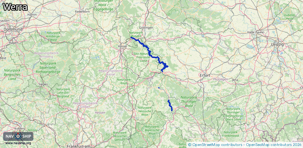
Route:
Please wait, loading route graphic...
Request waterway overview map with symbol legend here (Link).
Information about data associated with this body of water (11 available):
Data by OpenSeaMap (c) OSM contributors, www.openseamap.org
| # | Kind | Coordinates | Name | Information |
|---|---|---|---|---|
| 1 | Marina | 51.18419,10.16476 | 2025-01-12T16:17:15Z | Alter Hafen Wanfried https://www.wanfriederhafen.de/ |
| 2 | Marina | 51.07796,10.31145 | 2023-11-15T19:13:03Z | Wassersportfreunde Mihla e.V. https://commons.wikimedia.org/wiki/File:Mihla_Bild181.JPG |
| 3 | Bridge | 51.41726,9.66606 | Unknown | Clearance height: 2015-08-29T07:29:26Z m fixed |
| 4 | Bridge | 51.41725,9.66494 | Unknown | Clearance height: 2015-05-18T15:54:23Z m fixed |
| 5 | Bridge | 51.41892,9.65259 | Unknown | Clearance height: 2015-08-31T13:17:22Z m fixed |
| 6 | Slipway | 51.07894,10.33057 | small_craft_facility | 2016-05-11T18:16:45Z |
| 7 | Slipway | 50.83491,10.16599 | Unknown | 2023-07-27T12:18:21Z |
| 8 | Slipway | 50.57283,10.41167 | small_craft_facility | 2024-07-20T06:57:37Z |
| 9 | Slipway | 50.68603,10.35387 | small_craft_facility | 2024-07-20T06:57:37Z |
| 10 | Slipway | 50.68661,10.3536 | small_craft_facility | 2024-07-20T06:57:37Z |
| 11 | Lock | 51.40844,9.70735 | Unknown | |
| 11 | Lock | 51.40844,9.70735 | Unknown | |
| 11 | Lock | 51.40844,9.70735 | Unknown |