Waterway information

Kind:
Lower
Driving areas:
🇩🇪 Germany
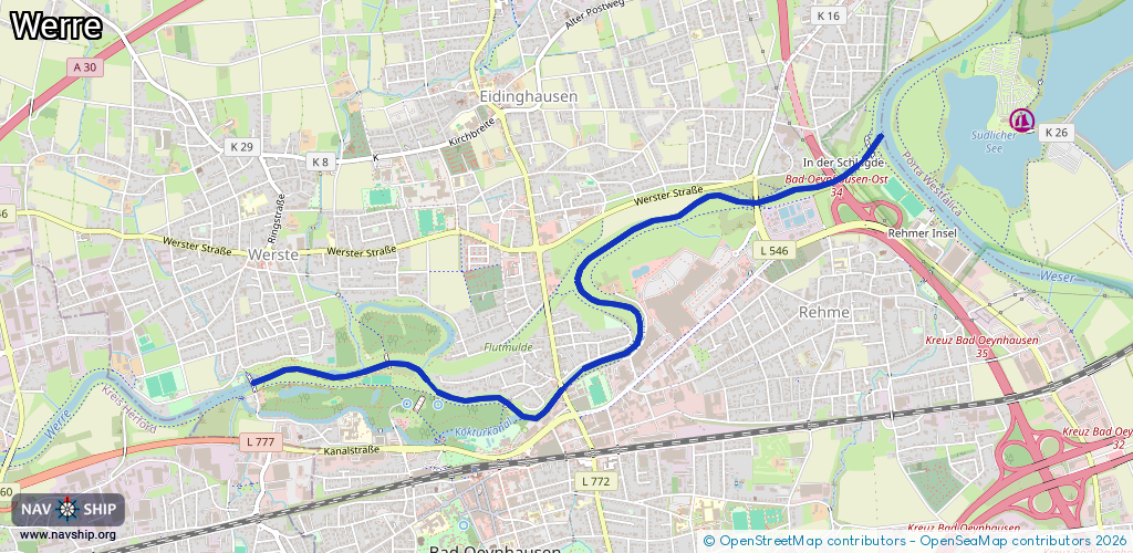
Length:
4.8 km¹
¹River kilometers or bank length recorded in NavShip, including river arms and harbor entrances.
Availability:
Completely recorded
Recent Update: 05.08.2025²
² This date indicates when an adjustment last took place in the course of the body of water
Recorded:
Locks: 0
Harbours / marinas: 0
Bridges: 5
Berths: 0
Slipways: 0
Fuelstations: 0
Route:
Please wait, loading route graphic...
Request waterway overview map with symbol legend here (Link).
Information about data associated with this body of water (5 available):
Data by OpenSeaMap (c) OSM contributors, www.openseamap.org
| # | Kind | Coordinates | Name | Information |
|---|---|---|---|---|
| 1 | Bridge | 52.21042,8.78986 | Unknown | Clearance height: 2012-12-13T14:21:23Z m fixed |
| 2 | Bridge | 52.20849,8.79914 | Unknown | Clearance height: 2012-12-13T14:21:22Z m fixed |
| 3 | Bridge | 52.21807,8.81837 | Unknown | Clearance height: 2012-12-13T14:21:23Z m fixed |
| 4 | Bridge | 52.21911,8.82446 | Unknown | Clearance height: 2018-11-22T10:02:32Z m fixed |
| 5 | Bridge | 52.22051,8.82727 | Unknown | Clearance height: 2012-12-13T14:21:44Z m fixed |