Waterway information

Kind:
Inland
Driving areas:
🌊 Atlantic Ocean🇺🇸 United States of America
Length:
7.9 km¹
¹River kilometers or bank length recorded in NavShip, including river arms and harbor entrances.
Availability:
Completely recorded
Recent Update: 18.01.2024²
² This date indicates when an adjustment last took place in the course of the body of water
Recorded:
Locks: 0
Harbours / marinas: 4
Bridges: 0
Berths: 1
Slipways: 0
Fuelstations: 0
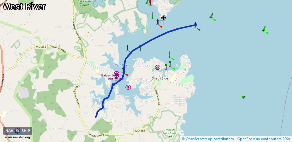
Route:
Please wait, loading route graphic...
Request waterway overview map with symbol legend here (Link).
Information about data associated with this body of water (5 available):
Data by OpenSeaMap (c) OSM contributors, www.openseamap.org
| # | Kind | Coordinates | Name | Information |
|---|---|---|---|---|
| 1 | Marina | 38.84313,-76.53857 | 2021-01-19T03:39:27Z | Pirates Cove +1 410 867 3600 http://piratescovemd.com/marina |
| 2 | Marina | 38.83752,-76.53134 | 2024-06-24T20:05:08Z | Chesapeake Yacht Club https://www.chesapeakeyachtclub.org/ |
| 3 | Marina | 38.84383,-76.53833 | 2020-05-19T21:33:26Z | West River Yacht Harbour customers http://www.westriveryachtharbour.org/ |
| 4 | Marina | 38.82918,-76.54777 | 2025-12-31T11:52:09Z | DiMillo's on the Chesapeake West Marina |
| 5 | Berth | 38.8416,-76.53886 | 2022-10-11T02:46:07Z | small_craft_mooring |