Waterway information

Kind:
Inland
Driving areas:
🇳🇱 Netherlands
Length:
2.3 km¹
¹River kilometers or bank length recorded in NavShip, including river arms and harbor entrances.
Availability:
Completely recorded
Recent Update: 08.05.2023²
² This date indicates when an adjustment last took place in the course of the body of water
Recorded:
Locks: 0
Harbours / marinas: 3
Bridges: 3
Berths: 0
Slipways: 0
Fuelstations: 0
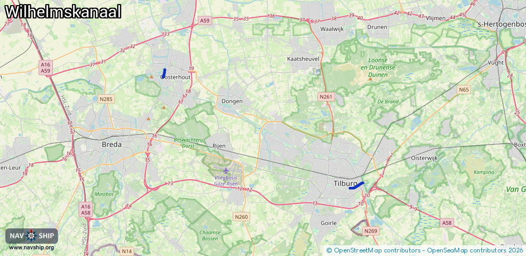
Route:
Please wait, loading route graphic...
Request waterway overview map with symbol legend here (Link).
Information about data associated with this body of water (6 available):
Data by OpenSeaMap (c) OSM contributors, www.openseamap.org
| # | Kind | Coordinates | Name | Information |
|---|---|---|---|---|
| 1 | Marina | 51.55236,5.09411 | 2022-05-16T15:04:38Z | Piushaven |
| 2 | Marina | 51.55226,5.09295 | 2020-11-25T09:00:38Z | Ponton Ontdek Tilburg |
| 3 | Marina | 51.64516,4.84263 | 2019-01-21T18:40:41Z | WSV Sluis 1 https://www.wsv-sluis1.nl/ |
| 4 | Bridge | 51.555,5.10618 | 17.6 | Clearance height: 2013-12-13T12:34:18Z m Maximum passage width: 5.21 m Movable bridge (e.g. lifting bridge or drawbridge) fixed |
| 5 | Bridge | 51.55412,5.10379 | 7.5 | Clearance height: 2022-11-04T12:31:34Z m Maximum passage width: 0.75 m Movable bridge (e.g. lifting bridge or drawbridge) opening |
| 6 | Bridge | 51.55283,5.10003 | 9.0 | Clearance height: 2019-01-23T11:51:12Z m Maximum passage width: 1.1 m Movable bridge (e.g. lifting bridge or drawbridge) opening |