Waterway information

Kind:
Inland
Driving areas:
🇬🇧 United Kingdom
Length:
18.7 km¹
¹River kilometers or bank length recorded in NavShip, including river arms and harbor entrances.
Availability:
Completely recorded
Recent Update: 17.06.2019²
² This date indicates when an adjustment last took place in the course of the body of water
Recorded:
Locks: 0
Harbours / marinas: 5
Bridges: 0
Berths: 0
Slipways: 0
Fuelstations: 0
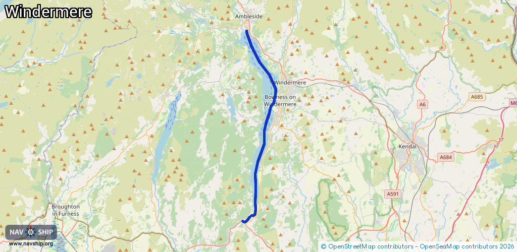
Route:
Please wait, loading route graphic...
Request waterway overview map with symbol legend here (Link).
Information about data associated with this body of water (5 available):
Data by OpenSeaMap (c) OSM contributors, www.openseamap.org
| # | Kind | Coordinates | Name | Information |
|---|---|---|---|---|
| 1 | Marina | 54.41775,-2.9608 | 2025-09-08T15:00:26Z | Waterhead Marine https://www.aquaticboatcentres.com/waterhead-marine/ |
| 2 | Marina | 54.40982,-2.94902 | 2021-03-30T22:24:05Z | Low Wood Bay Marina https://englishlakes.co.uk/low-wood-bay/low-wood-bay-marina/ |
| 3 | Marina | 54.36089,-2.92881 | 2021-07-14T19:46:55Z | Windermere Quays +44 15394 42121 https://www.aquaticboatcentres.com/windermere-quays-marina/ |
| 4 | Marina | 54.35366,-2.92603 | 2023-05-14T13:10:01Z | Windermere Marina Village https://www.windermeremarinavillage.co.uk/ |
| 5 | Marina | 54.35535,-2.92787 | 2023-05-14T13:10:01Z | Ferry Nab Marina https://www.southlakeland.gov.uk/leisure-culture-and-events/windermere-lake/ferry-nab-marina/ |