Waterway information

Kind:
Inland
Driving areas:
🌊 North Sea🇬🇧 United Kingdom
Length:
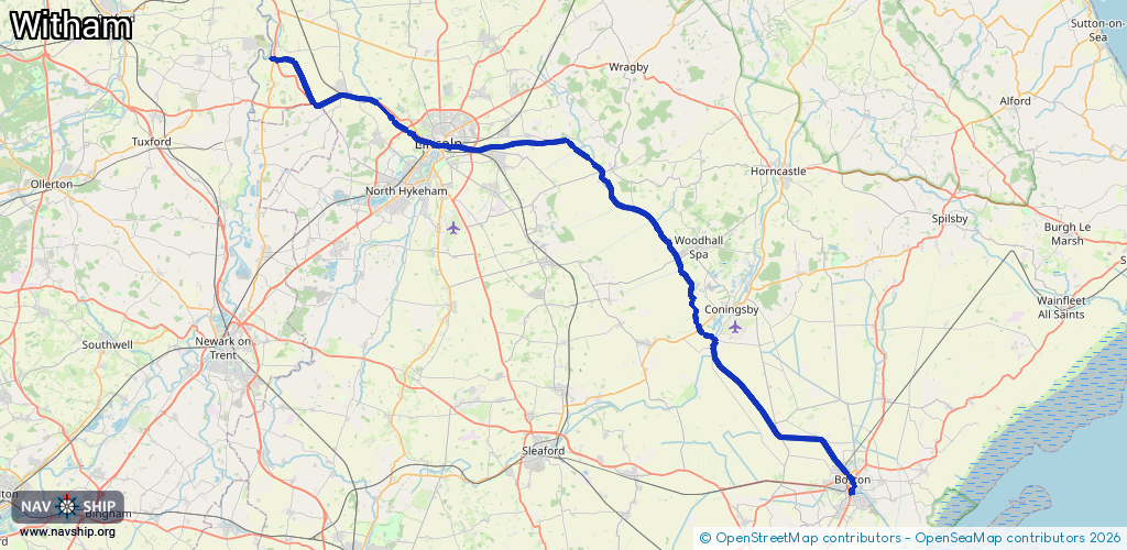
70.8 km¹
¹River kilometers or bank length recorded in NavShip, including river arms and harbor entrances.
Availability:
Completely recorded
Recent Update: 04.04.2025²
² This date indicates when an adjustment last took place in the course of the body of water
Recorded:
Locks: 3
Harbours / marinas: 4
Bridges: 0
Berths: 0
Slipways: 0
Fuelstations: 0
Route:
Please wait, loading route graphic...
Request waterway overview map with symbol legend here (Link).
Information about data associated with this body of water (7 available):
Data by OpenSeaMap (c) OSM contributors, www.openseamap.org
| # | Kind | Coordinates | Name | Information |
|---|---|---|---|---|
| 1 | Marina | 52.98269,-0.0312 | 2025-01-02T21:44:50Z | Boston Marina +44 1205 364420 http://www.bostonmarina.net |
| 2 | Marina | 53.22887,-0.54729 | 2025-06-06T20:05:22Z | Brayford Pool Marina |
| 3 | Marina | 53.24866,-0.59599 | 2024-03-25T12:56:46Z | Burton Waters |
| 4 | Marina | 53.2495,-0.59785 | 2020-12-29T21:33:27Z | Burton Waters |
| 5 | Lock | 53.21591,-0.34839 | Unknown | |
| 6 | Lock | 53.22768,-0.52939 | Unknown | |
| 7 | Lock | 53.29298,-0.74472 | Unknown |