Waterway information

Kind:
Inland
Driving areas:
🇳🇱 Netherlands
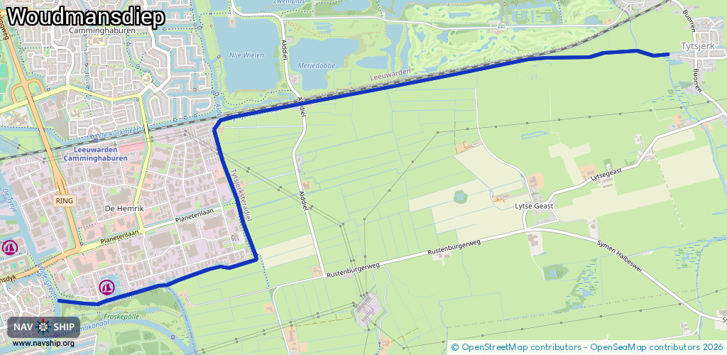
Length:
6.5 km¹
¹River kilometers or bank length recorded in NavShip, including river arms and harbor entrances.
Availability:
Completely recorded
Recent Update: 01.11.2021²
² This date indicates when an adjustment last took place in the course of the body of water
Recorded:
Locks: 0
Harbours / marinas: 1
Bridges: 2
Berths: 0
Slipways: 0
Fuelstations: 0
Route:
Please wait, loading route graphic...
Request waterway overview map with symbol legend here (Link).
Information about data associated with this body of water (3 available):
Data by OpenSeaMap (c) OSM contributors, www.openseamap.org
| # | Kind | Coordinates | Name | Information |
|---|---|---|---|---|
| 1 | Marina | 53.19147,5.84371 | 2023-05-30T12:17:41Z | Jachthaven de Hemrik [email protected] +31 58 785 0439 https://jachthavendehemrik.nl/ |
| 2 | Bridge | 53.19381,5.86192 | 6.88 | Clearance height: 2022-01-11T13:39:44Z m Maximum passage width: 2.95 m fixed |
| 3 | Bridge | 53.1905,5.84362 | 5 | Clearance height: 2020-05-21T20:22:29Z m Maximum passage width: 3.1 m Movable bridge (e.g. lifting bridge or drawbridge) fixed |