Waterway information

Kind:
Inland
Driving areas:
🇳🇱 Netherlands
Length:
10.5 km¹
¹River kilometers or bank length recorded in NavShip, including river arms and harbor entrances.
Availability:
Completely recorded
Recent Update: 03.10.2025²
² This date indicates when an adjustment last took place in the course of the body of water
Recorded:
Locks: 0
Harbours / marinas: 2
Bridges: 3
Berths: 0
Slipways: 0
Fuelstations: 1
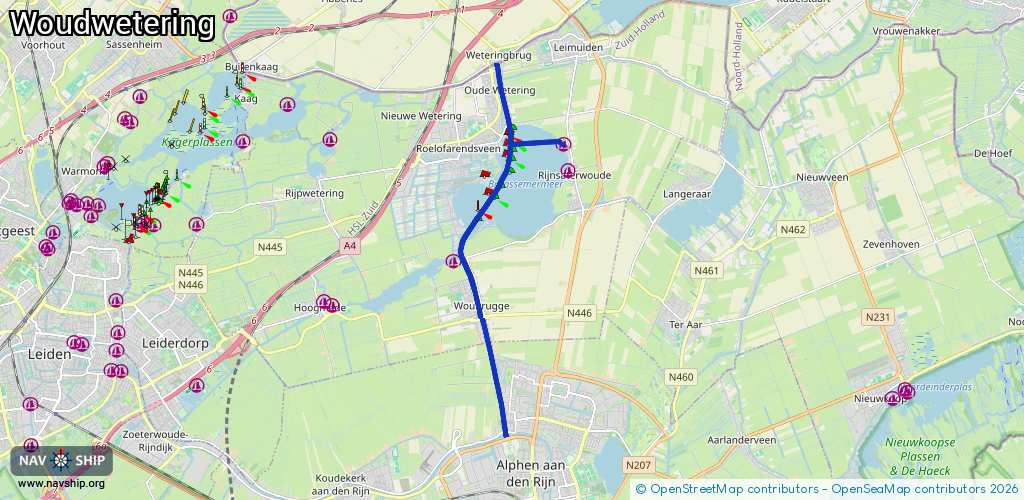
Route:
Please wait, loading route graphic...
Request waterway overview map with symbol legend here (Link).
Information about data associated with this body of water (6 available):
Data by OpenSeaMap (c) OSM contributors, www.openseamap.org
| # | Kind | Coordinates | Name | Information |
|---|---|---|---|---|
| 1 | Marina | 52.19788,4.66896 | 2024-10-09T10:53:05Z | Jachthaven 't Venegat |
| 2 | Marina | 52.20329,4.66748 | 2025-09-26T12:36:18Z | Jachthaven Meerzicht |
| 3 | Bridge | 52.16681,4.63932 | 5.5 | Clearance height: 2022-06-06T15:35:58Z m Maximum passage width: 2.6 m Movable bridge (e.g. lifting bridge or drawbridge) fixed |
| 4 | Bridge | 52.16677,4.63913 | 14.2 | Clearance height: 2022-06-06T15:35:59Z m Maximum passage width: 2.3 m Movable bridge (e.g. lifting bridge or drawbridge) opening |
| 5 | Bridge | 52.14299,4.64719 | 23 | Clearance height: 2022-06-06T15:34:01Z m Maximum passage width: 4.5 m Movable bridge (e.g. lifting bridge or drawbridge) opening |
| 6 | Fuel station | 52.18172,4.6327 | 2025-10-17T07:16:42Z | van Leersum Texaco https://www.vanleersum.com |