Waterway information

Kind:
Inland
Driving areas:
🇩🇪 Germany
Length:
1.4 km¹
¹River kilometers or bank length recorded in NavShip, including river arms and harbor entrances.
Availability:
Completely recorded
Recent Update: 11.05.2023²
² This date indicates when an adjustment last took place in the course of the body of water
Recorded:
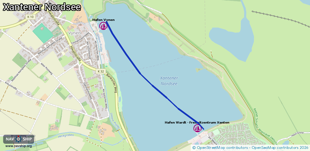
Locks: 0
Harbours / marinas: 2
Bridges: 0
Berths: 0
Slipways: 1
Fuelstations: 0
Route:
Please wait, loading route graphic...
Request waterway overview map with symbol legend here (Link).
Information about data associated with this body of water (3 available):
Data by OpenSeaMap (c) OSM contributors, www.openseamap.org
| # | Kind | Coordinates | Name | Information |
|---|---|---|---|---|
| 1 | Marina | 51.69469,6.4308 | 2013-01-17T15:21:11Z | Hafen Wardt - Freizeitzentrum Xanten http://www.freizeitzentrumxanten.de |
| 2 | Marina | 51.7037,6.41746 | 2023-08-15T22:56:51Z | Hafen Vynen [email protected] +49 2801 715656 |
| 3 | Slipway | 51.70342,6.41685 | small_craft_facility | 2021-01-14T11:10:45Z |