Waterway information

Kind:
Lower
Driving areas:
🇳🇱 Netherlands
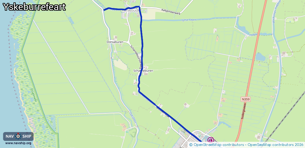
Length:
3.9 km¹
¹River kilometers or bank length recorded in NavShip, including river arms and harbor entrances.
Availability:
Completely recorded
Recent Update: 24.07.2023²
² This date indicates when an adjustment last took place in the course of the body of water
Recorded:
Locks: 0
Harbours / marinas: 0
Bridges: 12
Berths: 0
Slipways: 0
Fuelstations: 0
Route:
Please wait, loading route graphic...
Request waterway overview map with symbol legend here (Link).
Information about data associated with this body of water (12 available):
Data by OpenSeaMap (c) OSM contributors, www.openseamap.org
| # | Kind | Coordinates | Name | Information |
|---|---|---|---|---|
| 1 | Bridge | 53.00606,5.42471 | Unknown | Clearance height: 2021-05-25T23:38:37Z m fixed |
| 2 | Bridge | 53.00619,5.43157 | Unknown | Clearance height: 2021-05-25T23:38:37Z m fixed |
| 3 | Bridge | 53.00633,5.43426 | Unknown | Clearance height: 2021-06-05T16:53:31Z m fixed |
| 4 | Bridge | 53.00197,5.4348 | Unknown | Clearance height: 2021-05-25T23:38:37Z m fixed |
| 5 | Bridge | 52.99963,5.43515 | Unknown | Clearance height: 2021-05-25T23:38:37Z m fixed |
| 6 | Bridge | 52.99605,5.43501 | Unknown | Clearance height: 2021-05-25T23:38:37Z m fixed |
| 7 | Bridge | 52.99533,5.43481 | Unknown | Clearance height: 2021-05-25T23:38:37Z m fixed |
| 8 | Bridge | 52.99339,5.43419 | Unknown | Clearance height: 2021-05-25T23:38:37Z m fixed |
| 9 | Bridge | 52.98898,5.43934 | Unknown | Clearance height: 2021-05-25T23:38:37Z m fixed |
| 10 | Bridge | 52.98729,5.44307 | Unknown | Clearance height: 2021-05-25T23:38:37Z m fixed |
| 11 | Bridge | 52.98421,5.44926 | Unknown | Clearance height: 2021-05-25T23:38:37Z m fixed |
| 12 | Bridge | 52.98296,5.45193 | Unknown | Clearance height: 2024-04-19T20:51:42Z m Maximum passage width: 1.0 m fixed |