Waterway information

Kind:
Sea
Driving areas:
🌊 Baltic Sea🇩🇪 Germany🇵🇱 Poland
Length:
18.8 km¹
¹River kilometers or bank length recorded in NavShip, including river arms and harbor entrances.
Availability:
Completely recorded
Recent Update: 18.09.2025²
² This date indicates when an adjustment last took place in the course of the body of water
Recorded:
Locks: 0
Harbours / marinas: 5
Bridges: 0
Berths: 0
Slipways: 3
Fuelstations: 0
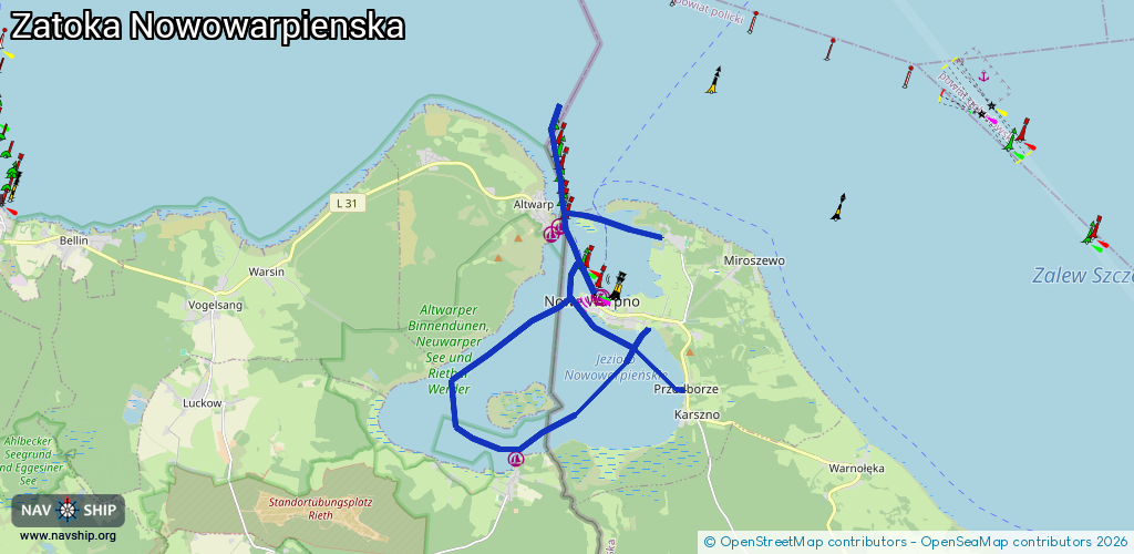
Route:
Please wait, loading route graphic...
Request waterway overview map with symbol legend here (Link).
Information about data associated with this body of water (8 available):
Data by OpenSeaMap (c) OSM contributors, www.openseamap.org
| # | Kind | Coordinates | Name | Information |
|---|---|---|---|---|
| 1 | Marina | 53.73874,14.27105 | 2019-03-01T23:12:30Z | Hafen Altwarp http://www.altwarp.inf o/index.php/hafen |
| 2 | Marina | 53.73731,14.26848 | 2025-09-11T22:54:04Z | |
| 3 | Marina | 53.72573,14.28321 | 2023-11-04T23:50:20Z | Marina Nowe Warpno [email protected] +48 796727777 https://marinanowewarpno.pl/ |
| 4 | Marina | 53.72523,14.28418 | 2024-04-09T12:06:12Z | port Nowe Warpno |
| 5 | Marina | 53.69623,14.25746 | 2025-09-11T21:52:47Z | Hafen |
| 6 | Slipway | 53.7369,14.3028 | small_craft_facility | 2020-07-02T22:29:51Z |
| 7 | Slipway | 53.73727,14.30277 | small_craft_facility | 2017-03-03T15:04:21Z |
| 8 | Slipway | 53.72575,14.28333 | small_craft_facility | 2017-03-03T15:04:15Z |