Waterway information

Kind:
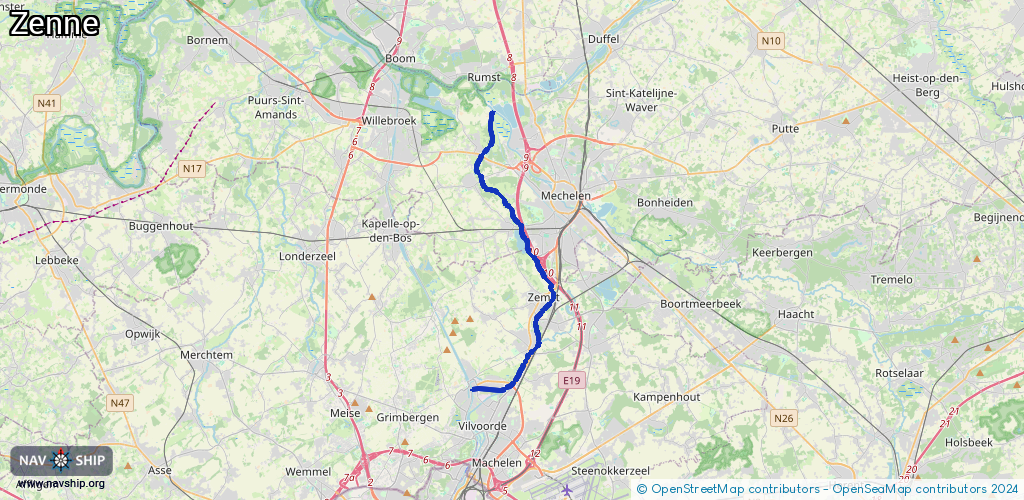
Inland
Driving areas:
🇧🇪 Belgium
Length:
17.7 km¹
¹River kilometers or bank length recorded in NavShip, including river arms and harbor entrances.
Availability:
Completely recorded
Recent Update: 28.03.2025²
² This date indicates when an adjustment last took place in the course of the body of water
Recorded:
Locks: 0
Harbours / marinas: 1
Bridges: 2
Berths: 0
Slipways: 0
Fuelstations: 0
Route:
Please wait, loading route graphic...
Request waterway overview map with symbol legend here (Link).
Information about data associated with this body of water (3 available):
Data by OpenSeaMap (c) OSM contributors, www.openseamap.org
| # | Kind | Coordinates | Name | Information |
|---|---|---|---|---|
| 1 | Marina | 50.94424,4.41847 | 2022-01-15T08:39:06Z | VVW - Jachthaven Grimbergen http://www.grimbergen-leeft.be/db/verenigingen_detail.php?ID=181 |
| 2 | Bridge | 50.94636,4.44265 | 3 | Clearance height: 2022-10-14T18:52:48Z m Maximum passage width: 1.5 m fixed |
| 3 | Bridge | 50.94472,4.41969 | 20 | Clearance height: 2020-03-06T21:25:08Z m Maximum passage width: 0.9 m Movable bridge (e.g. lifting bridge or drawbridge) opening |