Waterway information

Kind:
Inland
Driving areas:
🇳🇱 Netherlands
Length:
1.5 km¹
¹River kilometers or bank length recorded in NavShip, including river arms and harbor entrances.
Availability:
Completely recorded
Recent Update: 16.09.2022²
² This date indicates when an adjustment last took place in the course of the body of water
Recorded:
Locks: 0
Harbours / marinas: 2
Bridges: 1
Berths: 0
Slipways: 0
Fuelstations: 1
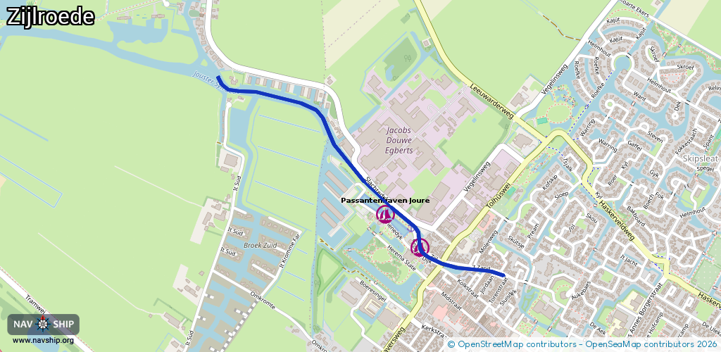
Route:
Please wait, loading route graphic...
Request waterway overview map with symbol legend here (Link).
Information about data associated with this body of water (4 available):
Data by OpenSeaMap (c) OSM contributors, www.openseamap.org
| # | Kind | Coordinates | Name | Information |
|---|---|---|---|---|
| 1 | Marina | 52.97077,5.79114 | 2022-05-27T07:42:26Z | Passantenhaven Joure |
| 2 | Marina | 52.97204,5.789 | 2023-09-17T19:59:02Z | Passantenhaven Joure https://www.passantenhaven-joure.nl/ |
| 3 | Bridge | 52.97018,5.79244 | 6.5 | Clearance height: 2018-08-08T15:16:41Z m Maximum passage width: 1.1 m fixed Tolhuisbrug |
| 4 | Fuel station | 52.97113,5.79122 | 2023-09-01T13:11:01Z |