Waterway information

Kind:
Inland
Driving areas:
🇳🇱 Netherlands
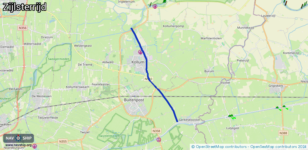
Length:
8.2 km¹
¹River kilometers or bank length recorded in NavShip, including river arms and harbor entrances.
Availability:
Completely recorded
Recent Update: 06.06.2019²
² This date indicates when an adjustment last took place in the course of the body of water
Recorded:
Locks: 0
Harbours / marinas: 0
Bridges: 8
Berths: 0
Slipways: 0
Fuelstations: 0
Route:
Please wait, loading route graphic...
Request waterway overview map with symbol legend here (Link).
Information about data associated with this body of water (8 available):
Data by OpenSeaMap (c) OSM contributors, www.openseamap.org
| # | Kind | Coordinates | Name | Information |
|---|---|---|---|---|
| 1 | Bridge | 53.24716,6.18835 | 8 | Clearance height: 2013-02-28T10:47:44Z m Maximum passage width: 3.1 m Movable bridge (e.g. lifting bridge or drawbridge) fixed |
| 2 | Bridge | 53.25627,6.17813 | 7.75 | Clearance height: 2013-02-28T10:47:44Z m Maximum passage width: 2.86 m Movable bridge (e.g. lifting bridge or drawbridge) fixed |
| 3 | Bridge | 53.26134,6.17143 | 7.8 | Clearance height: 2013-02-28T10:47:44Z m Maximum passage width: 3.1 m Movable bridge (e.g. lifting bridge or drawbridge) fixed |
| 4 | Bridge | 53.26142,6.17124 | 8.05 | Clearance height: 2013-02-28T10:47:44Z m Maximum passage width: 3.16 m Movable bridge (e.g. lifting bridge or drawbridge) fixed |
| 5 | Bridge | 53.26623,6.16363 | 7.93 | Clearance height: 2013-02-28T10:36:48Z m Maximum passage width: 2.97 m Movable bridge (e.g. lifting bridge or drawbridge) fixed |
| 6 | Bridge | 53.28043,6.15844 | 14.57 | Clearance height: 2013-02-28T10:36:50Z m Maximum passage width: 2.92 m Movable bridge (e.g. lifting bridge or drawbridge) fixed |
| 7 | Bridge | 53.28434,6.15647 | 14.50 | Clearance height: 2018-08-03T20:35:12Z m Maximum passage width: 2.92 m Movable bridge (e.g. lifting bridge or drawbridge) fixed |
| 8 | Bridge | 53.30161,6.14255 | 9 | Clearance height: 2013-02-28T10:42:45Z m Maximum passage width: 2.51 m Movable bridge (e.g. lifting bridge or drawbridge) opening |