Waterway information

Kind:
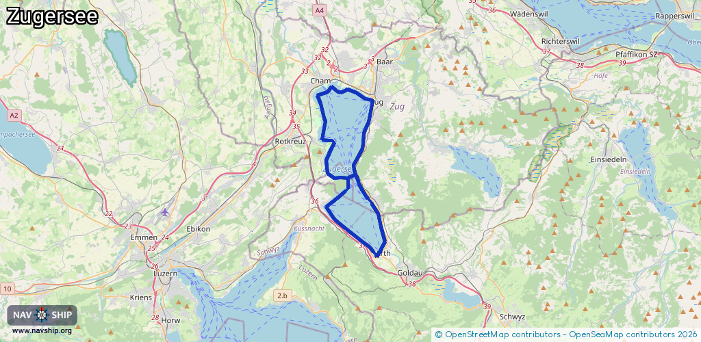
Lake
Driving areas:
🇨🇭 Switzerland
Length:
35.4 km¹
¹River kilometers or bank length recorded in NavShip, including river arms and harbor entrances.
Availability:
Completely recorded
Recent Update: 22.02.2026²
² This date indicates when an adjustment last took place in the course of the body of water
Recorded:
Locks: 0
Harbours / marinas: 4
Bridges: 0
Berths: 0
Slipways: 2
Fuelstations: 0
Route:
Please wait, loading route graphic...
Request waterway overview map with symbol legend here (Link).
Information about data associated with this body of water (6 available):
Data by OpenSeaMap (c) OSM contributors, www.openseamap.org
| # | Kind | Coordinates | Name | Information |
|---|---|---|---|---|
| 1 | Marina | 47.17301,8.50473 | 2024-03-06T20:07:49Z | Yachtclub Zug |
| 2 | Marina | 47.17074,8.50697 | 2021-05-24T19:52:50Z | Bootshafen Zug |
| 3 | Marina | 47.17177,8.50604 | 2024-03-06T20:11:13Z | Bootshafen Zug |
| 4 | Marina | 47.06772,8.52416 | 2019-01-28T19:27:01Z | Hafen Arth |
| 5 | Slipway | 47.17274,8.50523 | small_craft_facility | 2019-01-28T13:09:20Z |
| 6 | Slipway | 47.06869,8.52526 | small_craft_facility | 2019-01-28T19:27:02Z |