Waterway information

Kind:
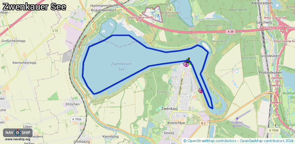
Lake
Driving areas:
🇩🇪 Germany
Length:
16.5 km¹
¹River kilometers or bank length recorded in NavShip, including river arms and harbor entrances.
Availability:
Completely recorded
Recent Update: 24.03.2021²
² This date indicates when an adjustment last took place in the course of the body of water
Recorded:
Locks: 0
Harbours / marinas: 2
Bridges: 0
Berths: 0
Slipways: 1
Fuelstations: 0
Route:
Please wait, loading route graphic...
Request waterway overview map with symbol legend here (Link).
Information about data associated with this body of water (3 available):
Data by OpenSeaMap (c) OSM contributors, www.openseamap.org
| # | Kind | Coordinates | Name | Information |
|---|---|---|---|---|
| 1 | Marina | 51.23481,12.3349 | 2024-09-30T15:41:36Z | Zwenkauer Hafen |
| 2 | Marina | 51.22487,12.34286 | 2023-12-29T08:59:25Z | Sportboothafen Anglerverband |
| 3 | Slipway | 51.23477,12.33605 | Unknown | 2021-08-07T06:00:59Z Slipanlage Hafen Zwenkau |