Waterway information

Kind:
Lake
Driving areas:
🇩🇪 Germany
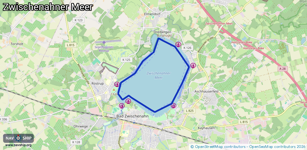
Length:
8.4 km¹
¹River kilometers or bank length recorded in NavShip, including river arms and harbor entrances.
Availability:
Completely recorded
Recent Update: 11.08.2021²
² This date indicates when an adjustment last took place in the course of the body of water
Recorded:
Locks: 0
Harbours / marinas: 6
Bridges: 0
Berths: 0
Slipways: 5
Fuelstations: 0
Route:
Please wait, loading route graphic...
Request waterway overview map with symbol legend here (Link).
Information about data associated with this body of water (11 available):
Data by OpenSeaMap (c) OSM contributors, www.openseamap.org
| # | Kind | Coordinates | Name | Information |
|---|---|---|---|---|
| 1 | Marina | 53.19561,7.99398 | 2025-05-22T11:34:14Z | Fischereihafen |
| 2 | Marina | 53.20926,8.02896 | 2021-07-12T03:02:42Z | Rabben |
| 3 | Marina | 53.20201,8.03743 | 2013-01-10T09:21:27Z | Segelsporthafen Oeltjen +49 4403 8457 |
| 4 | Marina | 53.18836,8.02652 | 2023-11-04T13:31:50Z | Zwischenahner Segelklub [email protected] +49 4403 59799 https://www.zsk-online.de/ |
| 5 | Marina | 53.18987,8.00062 | 2023-07-26T14:21:53Z | Yachthafen Bünting [email protected] +49 4403 4972 https://www.yachthafen-buenting.de/ |
| 6 | Marina | 53.18825,7.99673 | 2019-03-28T15:07:10Z | Yachthafen Eyhausen [email protected] https://eyhauser-segelclub.de/ |
| 7 | Slipway | 53.20174,8.0369 | small_craft_facility | 2013-01-10T09:21:29Z |
| 8 | Slipway | 53.20198,8.03679 | small_craft_facility | 2013-01-10T09:21:25Z |
| 9 | Slipway | 53.20172,8.03691 | small_craft_facility | 2020-02-10T06:09:29Z manually |
| 10 | Slipway | 53.18792,8.0272 | small_craft_facility | 2020-04-17T15:06:27Z Slip |
| 11 | Slipway | 53.18951,8.00109 | small_craft_facility | 2022-09-17T12:12:46Z |